Visit this page for regular bi-weekly updates during construction season on road and infrastructure projects currently underway in the Town of Renfrew.
The Town of Renfrew is committed to keeping residents and visitors informed about ongoing road and infrastructure projects throughout the community during the 2026 construction season. This page provides regular bi-weekly updates on current construction activities across the municipality, helping you stay aware of progress, impacts, and important timelines.
The Town also offer residents the bciti+ mobile app, a convenient tool designed to keep the community informed and connected. Through the app, residents will receive real-time alerts directly to their mobile device - helping you stay up to date on what’s happening in Renfrew, anytime and anywhere. Download and sign-up for the app today here!
About Our Road Network:
The Town of Renfrew is dedicated to maintaining a well-functioning and safe transportation network. With a total of 68.2 kilometers of roads (or 136.4 lane kilometers), our extensive network supports the movement of traffic, pedestrians, motorists, and cyclists throughout the town.
Our Responsibilities:
To ensure a safe and efficient travel experience, our team focuses on:
- Road Construction and Repairs: Implementing new road projects and addressing repair needs on our roads, sidewalks, curbs, and gutters.
- Road Closures and Detours: Managing planned road closures and detours to minimize disruptions and keep our community informed.
- Street Sweeping: Regularly cleaning streets to maintain road safety and aesthetics.
- Snow and Ice Removal: Clearing snow and ice to ensure safe travel during winter conditions.
- Traffic Management: Installing and maintaining traffic signals, pedestrian signals, road signs, and line markings to guide and protect all road users.
Looking for more information or have a concern? Please contact:
Justin Schauer, Manager of Engineering & Asset Management: jschauer@renfrew.ca or 613-432-4848 ext. 301
Current Projects
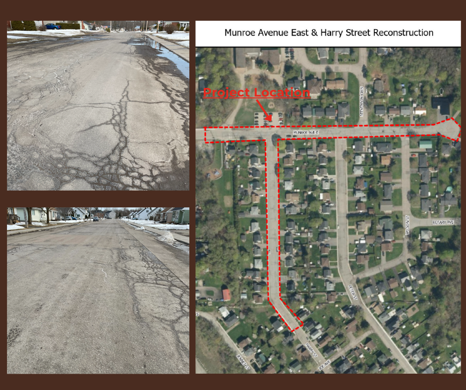
Munroe Avenue and Harry Street
Last Updated: July 16, 2026
Expected Completion Date: September 2026
Contractor: Thomas Cavanagh Construction Limited
Project Details:
The Town of Renfrew is proceeding with the reconstruction of Munroe Avenue East and Harry Street following the recent award of the contract to Thomas Cavanagh Construction Limited.
The project includes the replacement and upgrade of the existing underground infrastructure, the roadway structure, streetscapes, line painting and signage. As well as the addition of a pedestrian crossing and additional sidewalks to improve roadway safety and accessibility throughout the corridor.
Residents will be notified in advance of major construction activities, traffic impacts, and temporary service disruptions as the project progresses.
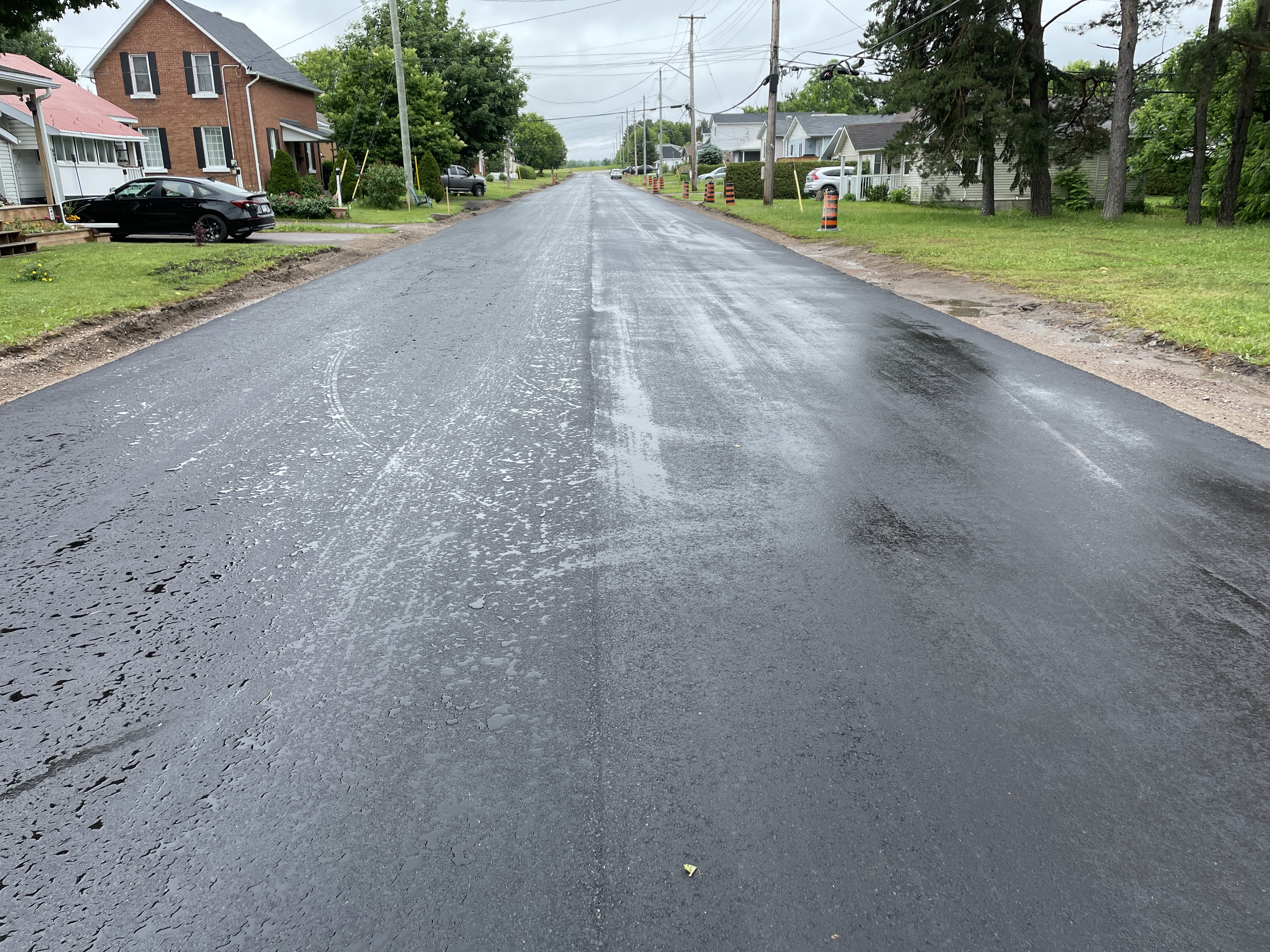
Seventh Street
Last Updated: July 16, 2026
Expected Completion Date: July 2026
Contractor: McCrea Excavating Ltd.
Project Details:
Progress to date includes the removal of asphalt and granular base materials, installation of the new granular base, grading, and completion of the base lift asphalt. Remaining work includes watermain looping, final paving, and associated restoration activities.
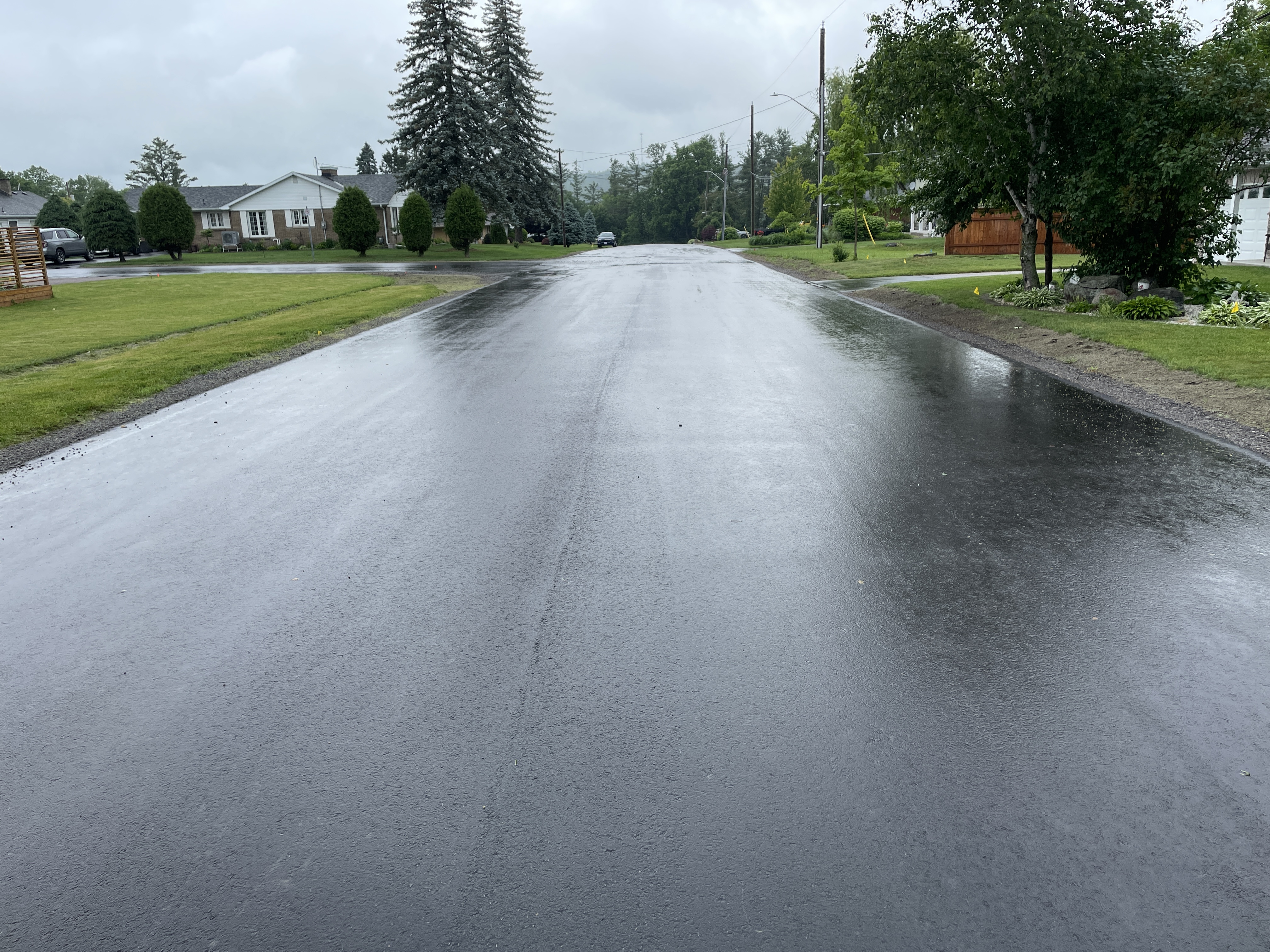
Stevenson Crescent
Last Updated: July 16, 2026
Expected Completion Date: June 2026
Contractor: McCrea Excavating Ltd.
Project Details:
The Stevenson Crescent Project is now complete. The work has provided a smoother driving surface, improved drainage, and full restoration of disturbed areas. The project was administered by Parsons Corporation, with construction carried out by McCrea Excavating Ltd..
Miscellaneous Road Rehabilitations Projects
Last Updated: July 16, 2026
Expected Completion Date: September 2026
Contractor: D Rock Paving
Project Details:
D Rock Paving is scheduled to mobilize to Town on Monday, July 20, with construction activities set to begin for the summer season. Residents can expect crews to be working in designated project areas, and we appreciate your patience and cooperation as this work gets underway.
The project includes rehabilitation work on the following roads:
Maloney Road from Bruce Street (north intersection) to Bruce Street (south intersection). Works include pulverizing the existing road surface, paving with a single lift of asphalt, shouldering, close cut clearing and property reinstatement.
Moore Street from Bruce Street to dead end (north of Bruce Street). Works include pulverizing the existing road surface, paving with two lifts of asphalt, structure adjustments, sanitary sewer lining, and property reinstatement.
Grigg Avenue from Raglan Street North to dead end. Works include milling the existing road surface, resurfacing with a single lift of asphalt, structure adjustments, and property reinstatement.
Raglan Street North from Bruce Street to Grigg Avenue. Works include milling the existing road surface, resurfacing with a single lift of asphalt, installing a concrete gutter, isolated sidewalk replacements, structure adjustments, and property reinstatement.
Railway Avenue from Plaunt Street South to dead end (at Algonquin Trail). Works include pulverizing the existing road surface, paving with a single lift of asphalt, structure adjustments, sidewalk removal and localized replacement, and property reinstatement.
Renfrew Avenue West from dead end to Carswell Street. Works include pulverizing the existing road surface, paving with a single lift of asphalt, structure adjustments, sidewalk and curb removal, and property reinstatement.
Rousselle Street from McAndrew Avenue to Elgin Avenue. Works include pulverizing the existing road surface, paving with a single lift of asphalt, structure adjustments, localized sidewalk replacement, and property reinstatement.
What is Municipal 511?
Municipal 511 is an interactive, map-based travel information service that provides real-time updates on municipal road conditions, construction projects, road closures, lane restrictions, special events, and other transportation-related impacts in Ontario. The platform allows municipalities across Ontario to share timely information with residents, businesses, and visitors, helping them plan their routes and travel safely.
Users can view current and upcoming road disruptions on an easy-to-use map, search specific locations, and access details about projects and closures affecting municipal roads. Municipal 511 serves as a central source for local transportation information, complementing Ontario 511, which focuses on provincial highways.